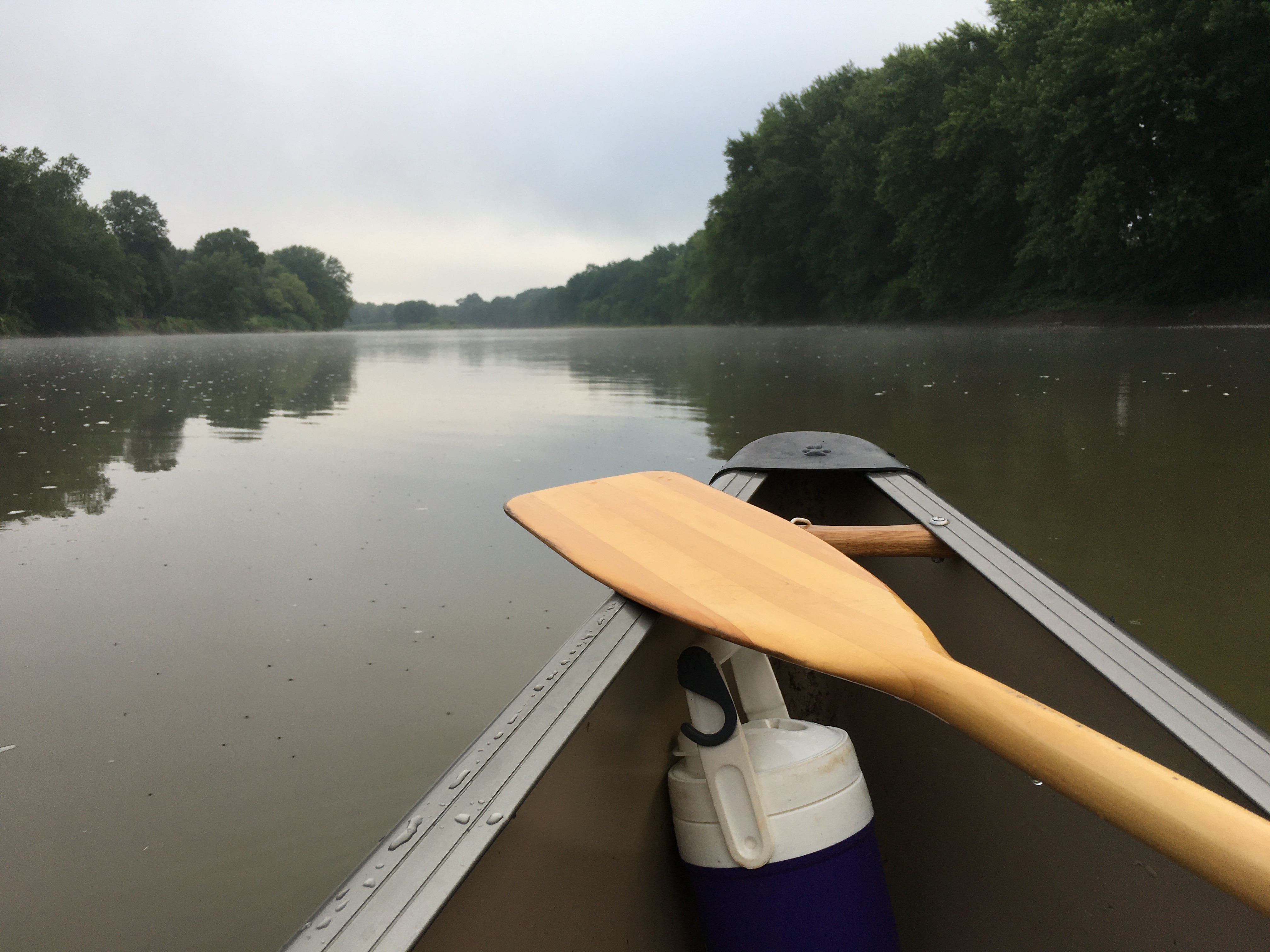
I am so rusty with my blog posting that I cannot even find where I posted the intro to our 2025 paddle down the length of the Connecticut River, so vital to the communities that have lived along it for millennia!
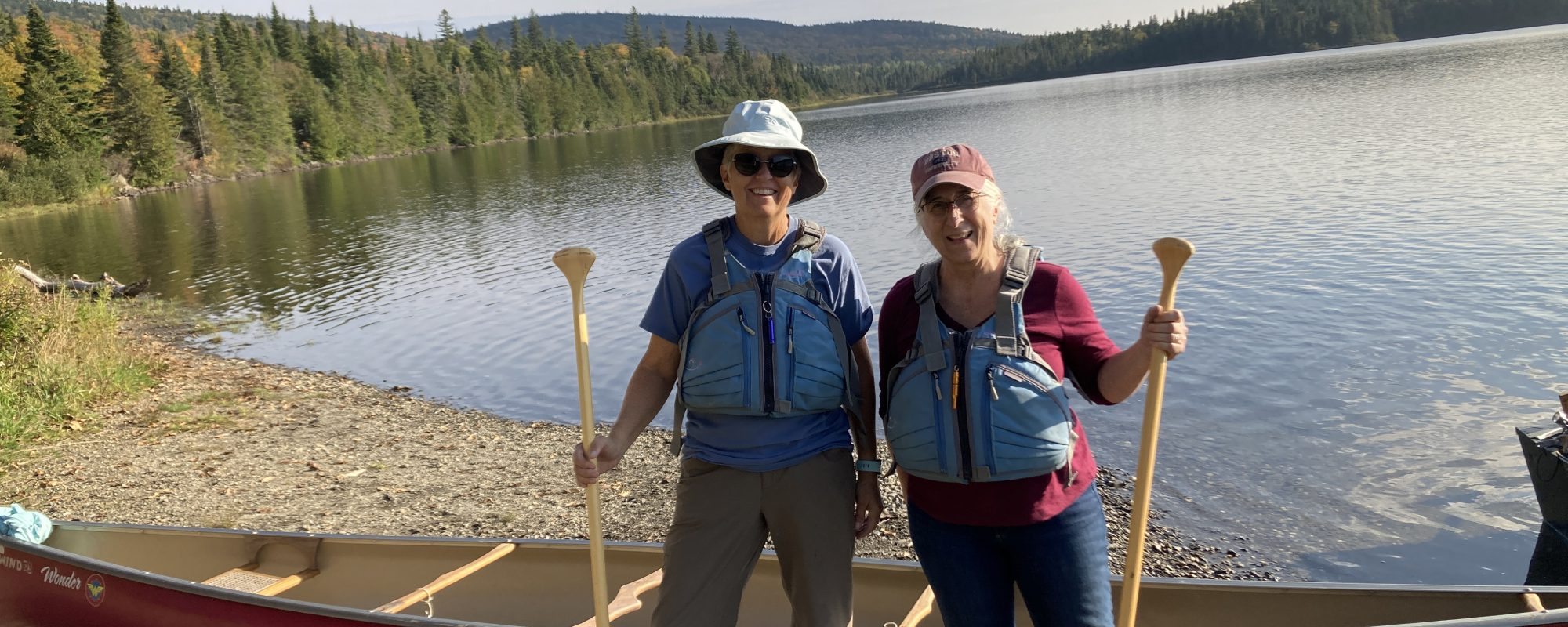
On Monday, May 19th, Karen and will put in at Canaan, VT. Preparing for this trip has been different for a few reasons. For one, we have never paddled a river that one of us has lived near at the time. I once lived near the Susquehanna which we travelled a few years ago but at the time had no interest in the river. Now I cross the Connecticut between Windsor, VT, and Claremont, NH, several times a week. I see it in all seasons and water levels. This year, John and I were even able to do some reconnaissance around some of the bigger dams to determine whether Karen and I would portage ourselves or ask for help. It will be a little of both, it turns out. We had a great afternoon last weekend exploring the Moore Dam, Comerford Dam, McIndoes Dam, and Wells River Dam. We will take our canoe dolly this year to pull the canoe around some of these dams.
I have also studied up maps and some great books about the river more than I usually do. I guess I am more interested because we have lived here for a while.
But the big difference in planning is that we are going out for two weeks to cover the whole river from below the Connecticut River Lakes in Northern NH to the Long Island Sound! Two years ago, we paddled the Connecticut River Lakes but the stream to Canaan, VT, is not navigable in our canoe so we will put in below the dam at Canaan. This is a week more than we have ever paddled. So, let’s see how young our bodies are after sleeping on the ground that long. The night temps are looking to be in the 40s as well. Good news is that since we are close to our home, we will spend at least one night in West Windsor, VT, with guaranteed hot showers and flushing toilets!
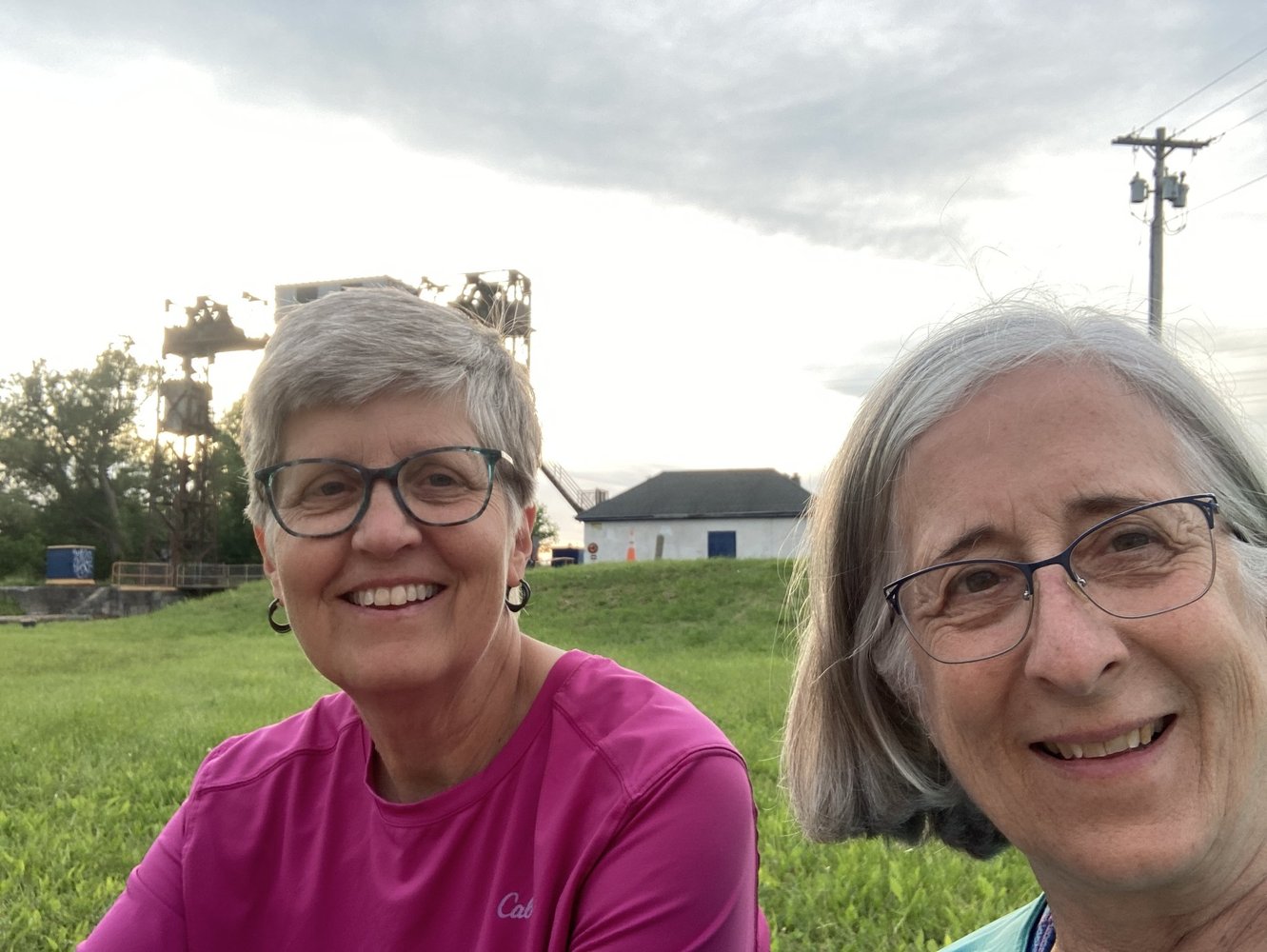
We were happy to join others on the river/canal or hiking/biking on the trails alongside the canal on what was called the Canalway Challenge!
We seem to all know the song even if we weren’t born in New York State. That’s because the Erie Canal had a huge impact on the growth of the United States in so many ways. We think there was only one day, however, that we actually did about 15 miles. Generally, we did more.
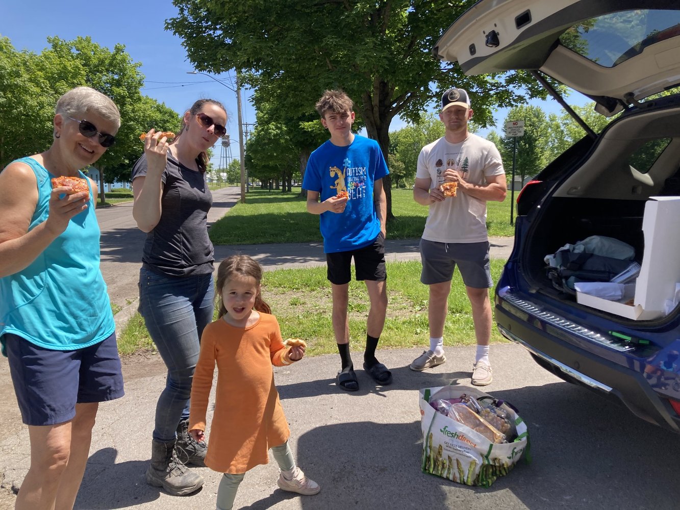
Looking at the maps ahead of time, the best place to put in looked to be Rome, NY. We had hoped to actually get to some place considered the headwaters of the Mohawk but we could not get a straight answer about whether we could paddle from the headwaters so we found the closest convenient place which is where the original Mohawk River meets the Erie Canal in Rome. The next step is always to find help in taking Karen’s car after we put in and keeping it for the week, then meeting us wherever we get out. Maggie always does this work of finding our helpers or “river angels.” This year she took at extra chance that is quite a story. Maggie and John adopted their daughter Chelsea and knew that her bio family was from around that area. We have become acquainted with them over the last several years. So, Maggie reached out to bio-Mom, Angela, to see if there were any relatives who might take this on. Angela would not be in NYS at that time but arranged for her college age nephew Charlie to meet us.
Charlie and Friend enjoying pizza with us prior to taking off.
Chelsea and granddaughter Pippa (4 years old) were there to see us off as well. It was part of the logistics of me getting there. It was fun to introduce the next generation to our trips. And we were excited to meet another member of the bio family. What we didn’t know was that Charlie did not know that Chelsea was related to him. The look on his face when he learned that the two of them were first cousins was priceless. He and the friend he had with him handled it well and we all became friends fast. Charlie kept in touch with us as we made our way across the canal and was there for us in Rotterdam when we get out of the canal. What we have learned on our journeys more than anything is that we are all connected to each other on this planet. On this trip there was a closer biological connection.
Day One: Bellamy Harbor Park in Rome Mile Marker 114.97 to Utica Historic Marina, Mile Marker 100.85 – June 1
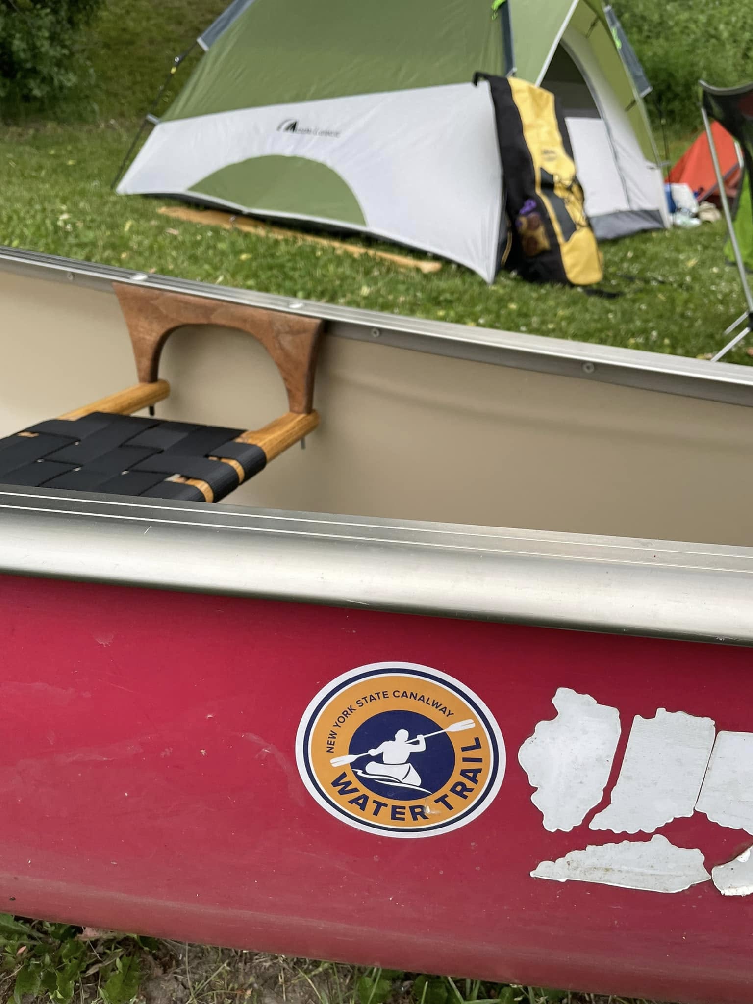
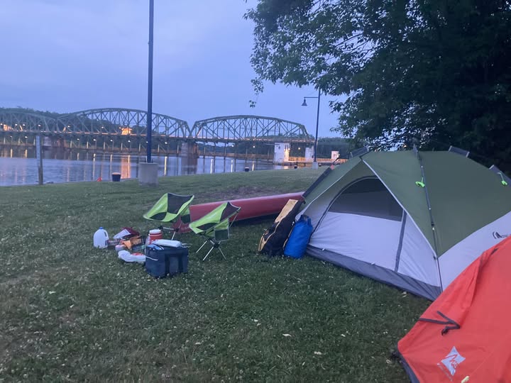
We put in about 1 pm on June 1 at Mile Marker 114.97. Bellamy Harbor Park had a good dock and, with the help of the abovementioned team, we carted all the equipment from the car to the canoe and set sail. The timing worked for our first night to stay at this decommissioned lock. We were fortunate throughout the week to be able to stay along the river on grassy areas around the locks, often with the comfort of a portapotty and sometimes water. This first night did not disappoint. We pulled up to the shore and climbed the steep incline up to the mown grass. A walking/biking trail went right through the area. For most of the length of the canal one can find this trail closer or farther from the water. Here it was right where we were planning to camp with no cover. There was a family fishing and we asked if they thought it was safe to camp there. They pointed to another tent tucked further way along the trees. We took that to be a yes and set ourselves up against this concrete structure. We were thankfully not bothered by any passers-by on the trail. And, having slept on everything from flat rocks to mud to pebbles over the years, we were particularly thankful for that soft grass.
Our first night on the canal in Utica near the old lock that used to serve as the port of Utica.
Day Two: Utica Historic Marina to Little Falls, Mile Marker 80.10 – June 2
We set out at 6:45 am. We have learned that it is good for us to break down our camp and set out before we eat breakfast. We get a few miles under our canoe before we find a place to eat our eggs and crackers. The going seemed quite tough this year, but we think it’s that our aging bodies are … well, aging! Also, no current to help us. But we enjoyed the challenges, the beauty, the interesting places enough to make ourselves tired and sore! We found a beautiful tiny marina in Little Falls complete with showers and toilets: Little Falls Canal Harbor and Rotary Park. Thank you, Rotary Club of Little Falls. Sleeping on grass once again (a treat on any of our adventures), Maggie took to her tent as soon as she had some peanut butter and crackers. She was done in after the long day of paddling: 12 hours on the river. Karen had a little more stamina to catch up on Facebook posts. Lesson learned at this stop: if there is a key to the bathroom involved, make sure that both parties have access to it so as not to have to wake the other up in a moment of desperation. The park was too public to use Mother Nature!
We couldn’t get through the next lock until 7:30 or eight the next morning so we planned to take a leisurely walk to find a diner for breakfast before heading out. The photos below are from the bridge crossing the canal over to the quaint town of Little Falls. We thought this was going to be a different kind of trip. But we did not expect most of the wildlife would be in the form of people in yachts coming from the south back to the north to various ports and bays in the Great Lakes. Several are docked here this morning. They have great stories to tell.
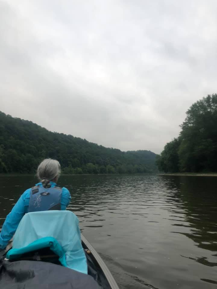
Our new toy/tool this year – a marine radio. On the Ohio River we called the locks from our cell phone to let them know we were approaching. This year we brought a marine radio, and we are glad we did. The first lock master today didn’t answer the phone so we set the radio to channel 13, for the locks, and learned the lingo enough to let them know we were eastbound and wanted to lock through. As helpful as it was, it also caused some tension between us as Maggie liked to call the yachts to see where they had come from and where they were going. Sometimes Karen thought Maggie stayed on too long chatting as the radios are supposed to be used for navigation or emergencies. But we ended up learning that some boats were finishing year long trips, some coming from the Gulf of Mexico and others coming from the Carolinas. This was our first introduction to this kind of boating. Though we had been on bodies of water that connected major ports in the world to the interior of the United States in the past, most of the previous traffic we came into contact with on the big rivers was commercials. Some of the folks on those yachts were equally impressed with our journeys in our small boat.
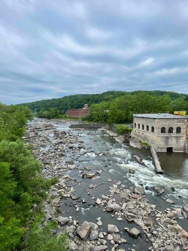
This is the part of the river that skirts the dam.
This is the part of the river that is navigable. You can see why locks and dams are so important.
Little Falls is a cute old mill town that has turned factories into shops, as so many post-industrial towns and cities in the northeast have done. Crossing the bridge over the canal and the wilder Mohawk River gave us a different perspective than when we’re on the water.
Day 3 Little Falls to Canajoharie, River Mile 60.55 – June 3
After a good breakfast, we were on our way and through our next lock almost immediately. It was the first of four the day. That may have been an all-time high for us. The structure of the canal was very clear there with some of the high sides cut into rock and some made by building walls. Today brought a little current our way and made our 20-mile paddle easier and shorter. Weather was beautiful and hot, and the river scenery a bit different than the two previous days. We continue to run parallel to the interstate and to a double set of railroad tracks, so lots of traffic and train noise serenades us as we go. Nature sightings featured one bald eagle and lots of goose families.
Our day ended in Canajoharie which is another cute little mill town. Since we arrived around 5:45 we had plenty of time to find dinner in town at a taco joint called Taco 29, and to spot a restaurant for breakfast the next day. The restaurants along the way are among the highlights of our trips. We never know if and what we will find. A beautiful sunset and a walk across another bridge over the canal for Karen gave her an opportunity to capture a great sunset and finished things off well for the day.
We pitched camp in the Canajoharie Riverfront Park. We are always a little leery of being exposed to the public that may come down to the water at all times of the day or night, but we set up the tents a bit off the beaten track and felt safe. Some of the entertainment there included the fire department teaching some teenagers how to use the fire hoses. It was hot and, at first, we thought they were filling a portable container as a small swimming pool. And then the hoses came out.
Setting sun over Lock #4 at Canajoharie
Day 4 Canajoharie to Lock E12, Tribes Hill-Mile Marker 43.52-June 4
Trains, boats and automobiles. And lots of trucks! Canajoharie was perhaps the noisiest of camping places we found. Peaceful sleeping was not in the cards. The Erie Canal lies in the middle of a transportation corridor that is centuries old. In this era, the highway and the railroad carry the freight, the Canal is pretty much for recreational vessels. As we hear the constant high-speed traffic around us, we are reminded of the need to slow down, relax, stay in the moment. And that’s what we tried to do today. For the first time on a canoe trip, Karen didn’t check her watch and the maps to try and compute the speed we were traveling or think too much about what our daily destination would be. We decided to take it a bit easy and enjoy both the ride and the stops. We enjoyed at stop and rest of the offices of the Canal Corporation offices in Fonda where we ate our lunch.
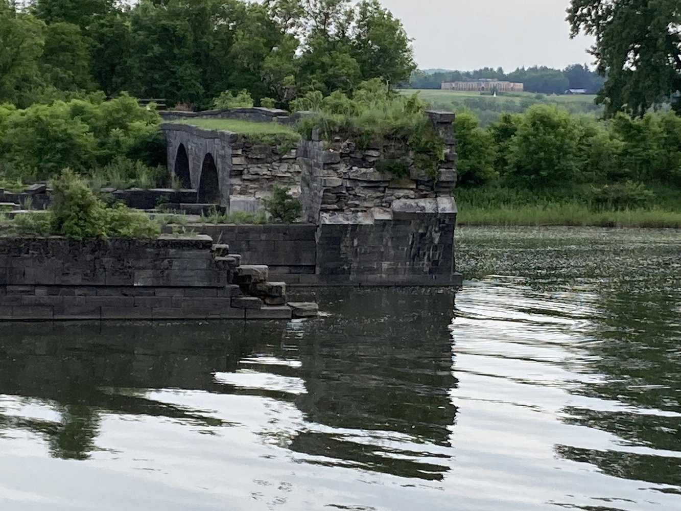
Part of taking it easy was taking the time to visit an historic site along the way. We were going to be going right by the ruins of the Schoharie Aqueduct at the Schoharie Crossing State Historic Site at mile marker 43.90. We decided to take the time to walk inland a bit and explore the historic area. We were not disappointed. The aqueduct was a narrow part of the old canal that passed OVER the Schoharie River right near where it dumps in the Mohawk River/Erie Canal. The stonework was amazing and imagining water crossing water and carrying barges pulled by mules was not difficult. As well as ruins, we found many signs warning us of the dangers of ticks. Nasty little things but we were well prepared throughout the trip with repellent and spray for our tents and equipment as well. It was a bad year for ticks in New York State.
Another gorgeous day on the canal came to an end with enough firewood for a campfire. We enjoyed watching a young man skipping stones. And a land turtle visited our site!
Day 5 – June 5 – Lock E12 to Scotia/Rotterdam Mile Marker 24.04-June 5
Further down river we took a break on this hot day at the Amsterdam Riverlink Park. We walked over the pedestrian bridge with art installations and saw the local Peregrin falcon. We found a “famous” hot dog joint (Guge’s Dogs) and chatted with others along the away.
We finished the paddling part of our journey on June 5 at about 7:30 pm. A summary of our last day:
Three things characterized our day: fun nature sightings, a beautiful riverfront park, and headwinds. Ugh! We battled headwinds for much of the Ohio River, expected as we paddled toward prevailing winds. But we didn’t expect them on this trip paddling west to east. So, we were surprised and aggravated that most of the wind we experienced was in our faces. Oh well, we still made our 20-mile goal for the day and we are sure we’re stronger for it
June 6 – 90 miles later…
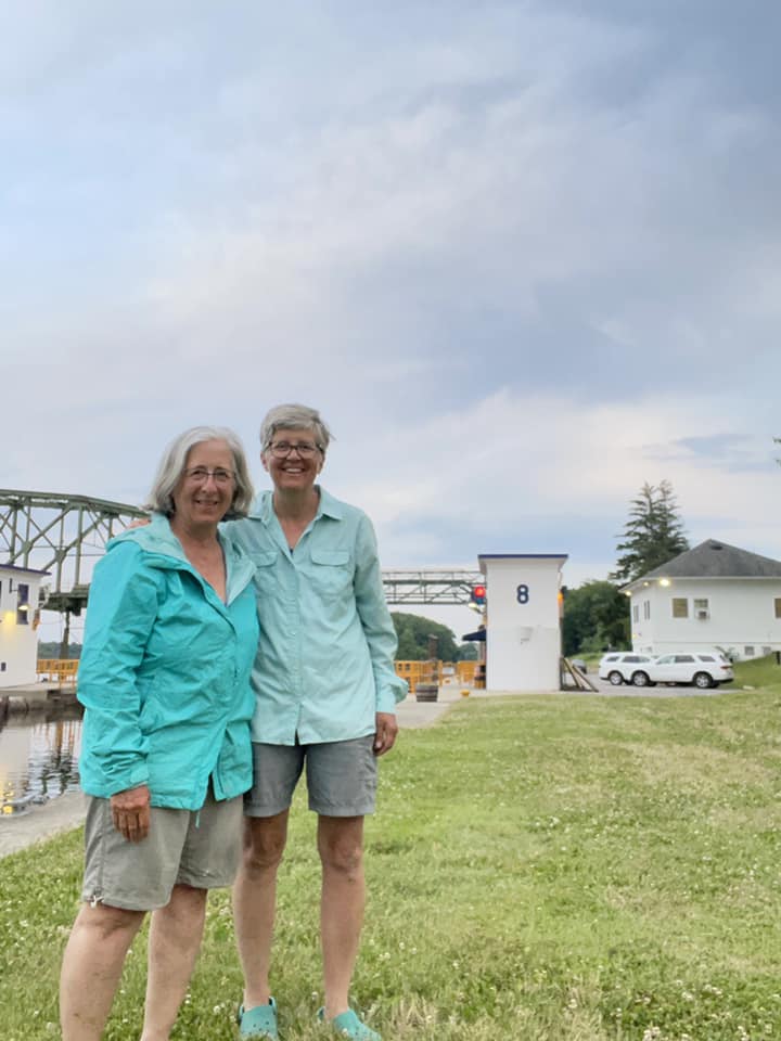
Met by Charlie who brought Karen’s car to us and John who came to fetch Maggie back to Vermont. Our initial goal was to try to get to Troy and to descend Waterford Flight on 5 locks, one right after the other, dropping down to the Hudson River. We would likely have needed at least another full day and, having learned over the years when to stop, we were happy to end safely in Scotia.
I was surprised to see that my last post did not even include our completion of the Susquehanna River last summer. I think it is a result of the blur that all of our lives have been for a few years…and the reality that we post updates on Facebook and then forget to create a post here. With a bit of back peddling (or paddling, as the case might be) perhaps I can catch up on the later. But for now, we turn our minds to the Connecticut River whose headwaters are in the North Country of New Hampshire. That is the bit of New Hampshire that looks like it should be Canada as it juts up into Quebec.
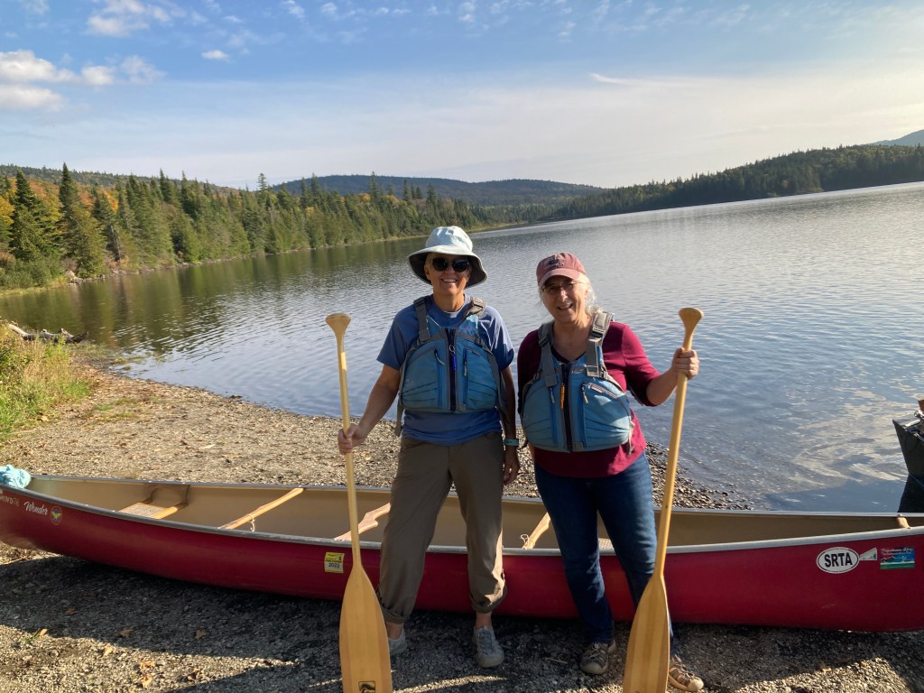
This trip was a little different from others. We brought along our spouses. We arranged a couple of days in an Air B&B and lucked out with a nicely appointed log cabin overlooking one of the lakes. The furniture lent itself perfectly to a place for Mark and John to chill while Karen and I tackled the first waters of the river.
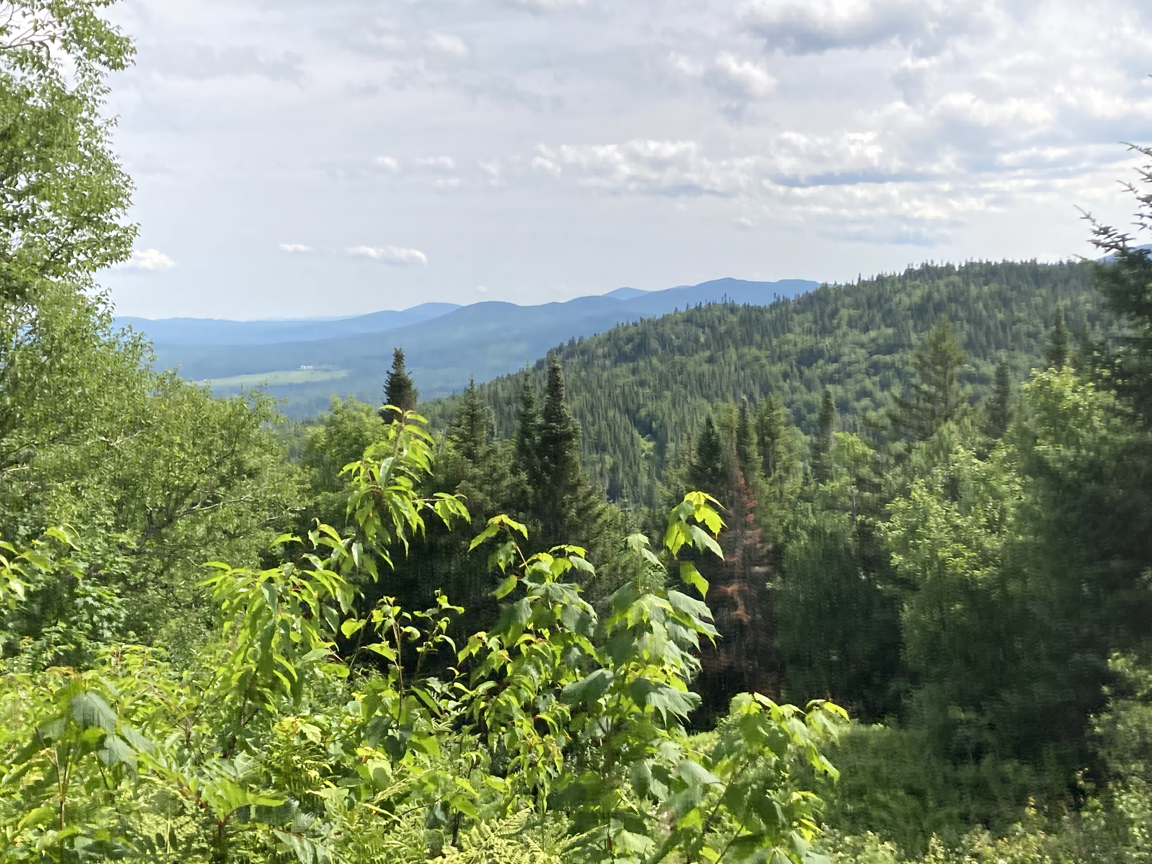
It is gorgeous there. Mountains and lakes and rivers. Everyone likes the outdoors there in all four seasons. Well, does anyone actually like mud season and is there really anything you can do in mud season that is fun? Maybe you have to be a New Englander to know what I am talking about. Mud season aside, it is stunning, and we went to explore it at the best time: autumn. The leaves were starting to turn and made lovely reflections in the lakes. The loons called out and flapped their wings. The bald eagle soared above, and the heron swooped across the sky like the pterodactyl from which it appears to be descended.
The only thing that disappointed us was the lack of moose. We are convinced that it is a PR ploy of New England when you see moose crossing signs. They are just luring us to spend money in the region and get up at the crack of dawn, drive miles down the road to wait and watch and maybe see a moose. No go. Do they really exist? Are the pictures photoshopped? Are the locals laughing at us as we leave the house in the dark of the morning with hope in our hearts? One has about as good a chance at seeing a moose in New Hampshire as winning a big lottery jackpot!
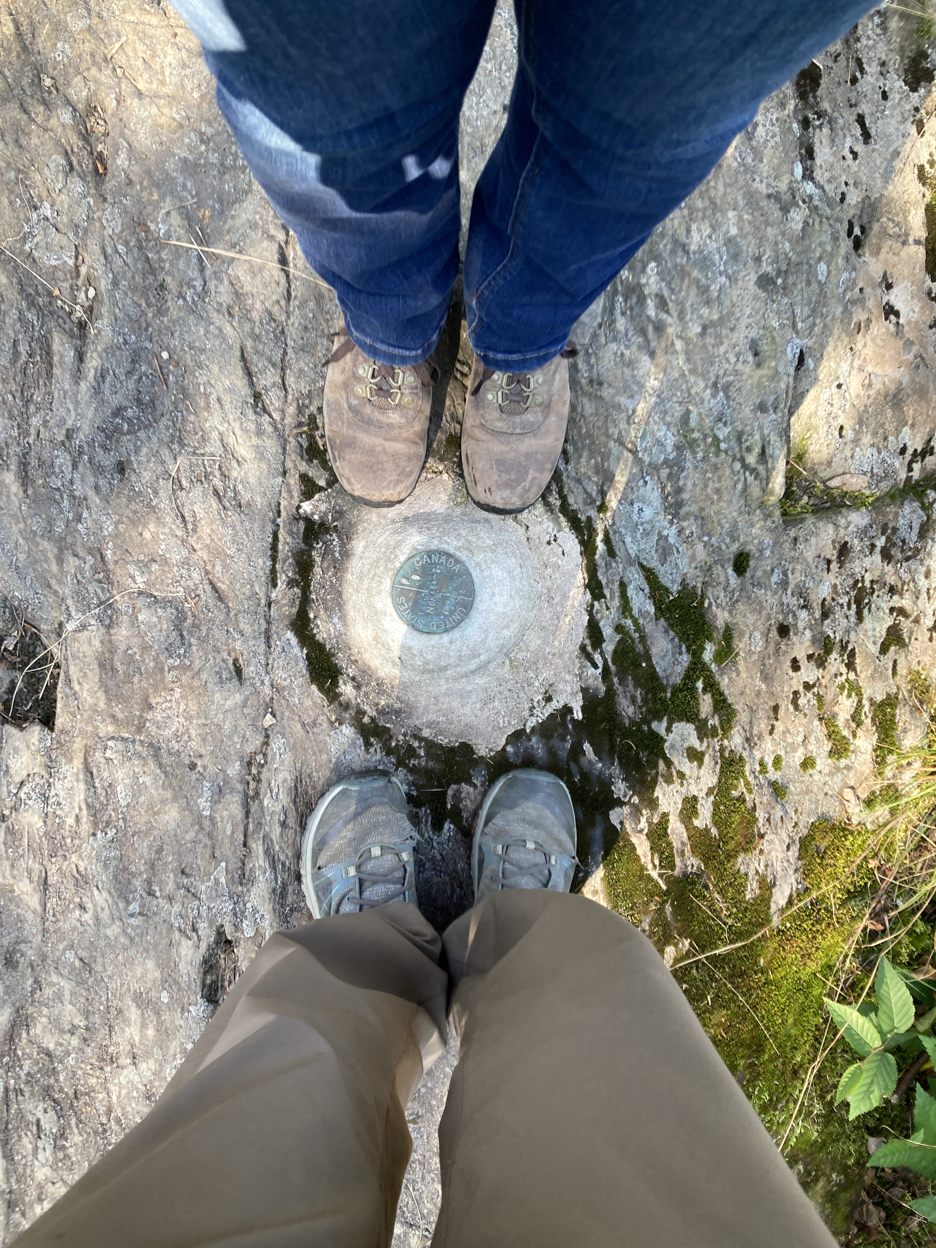
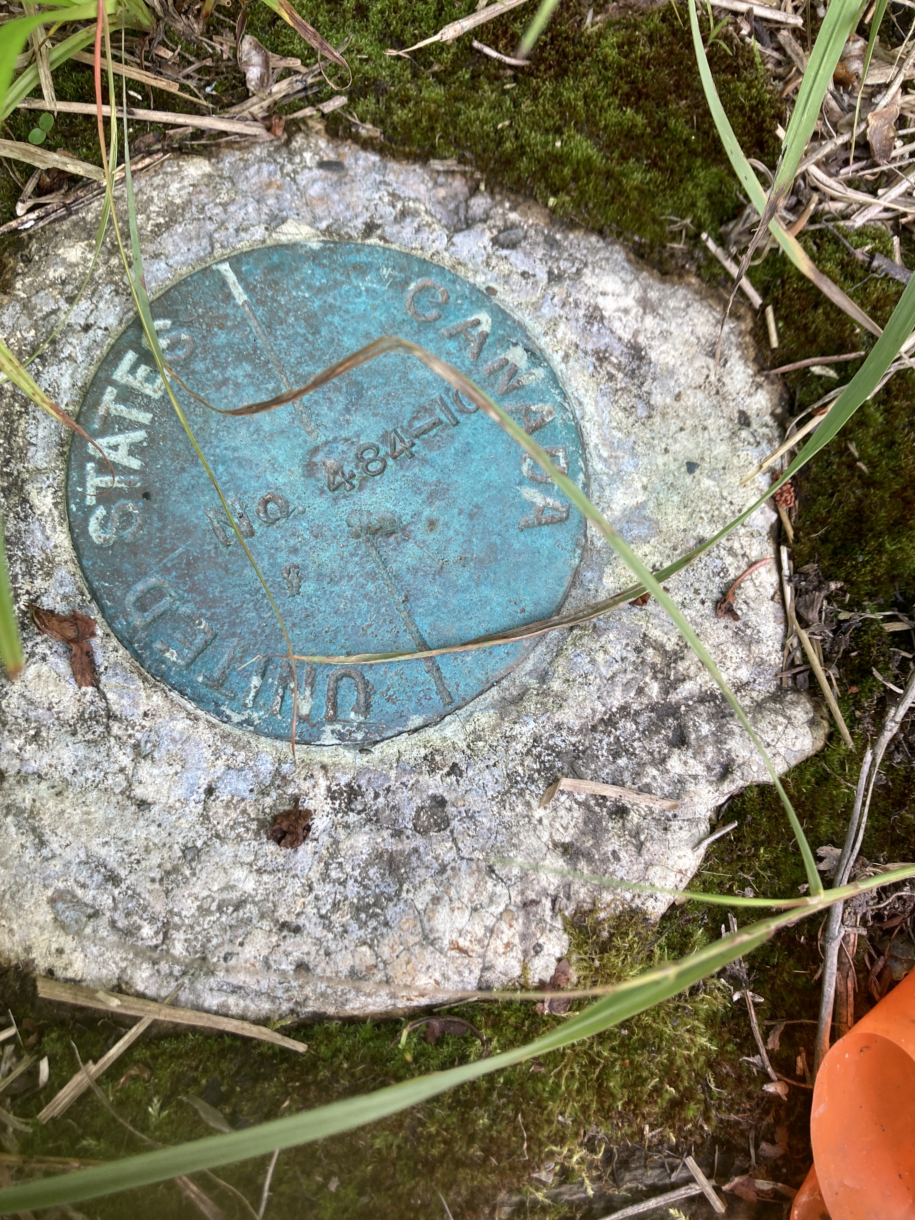
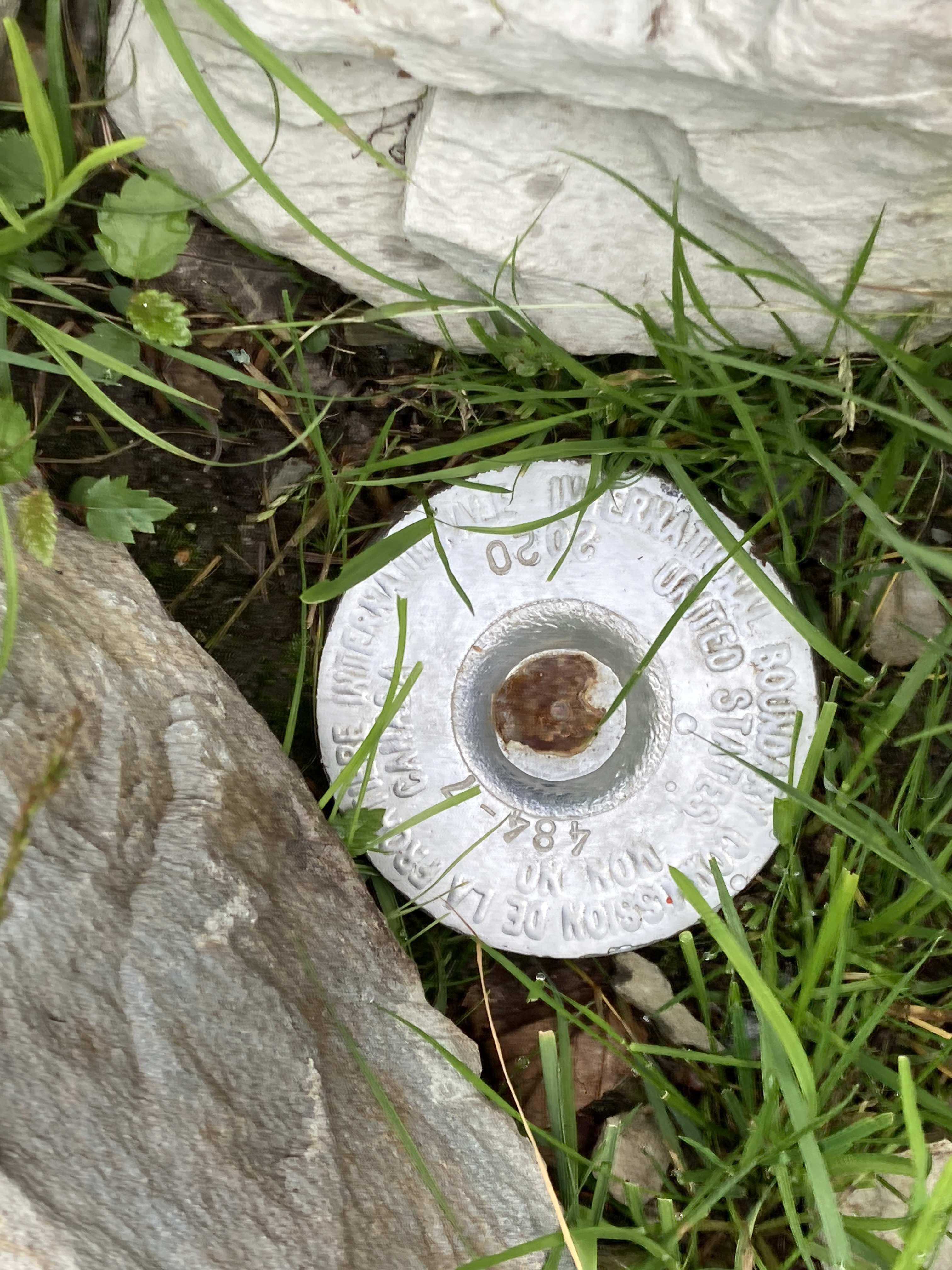
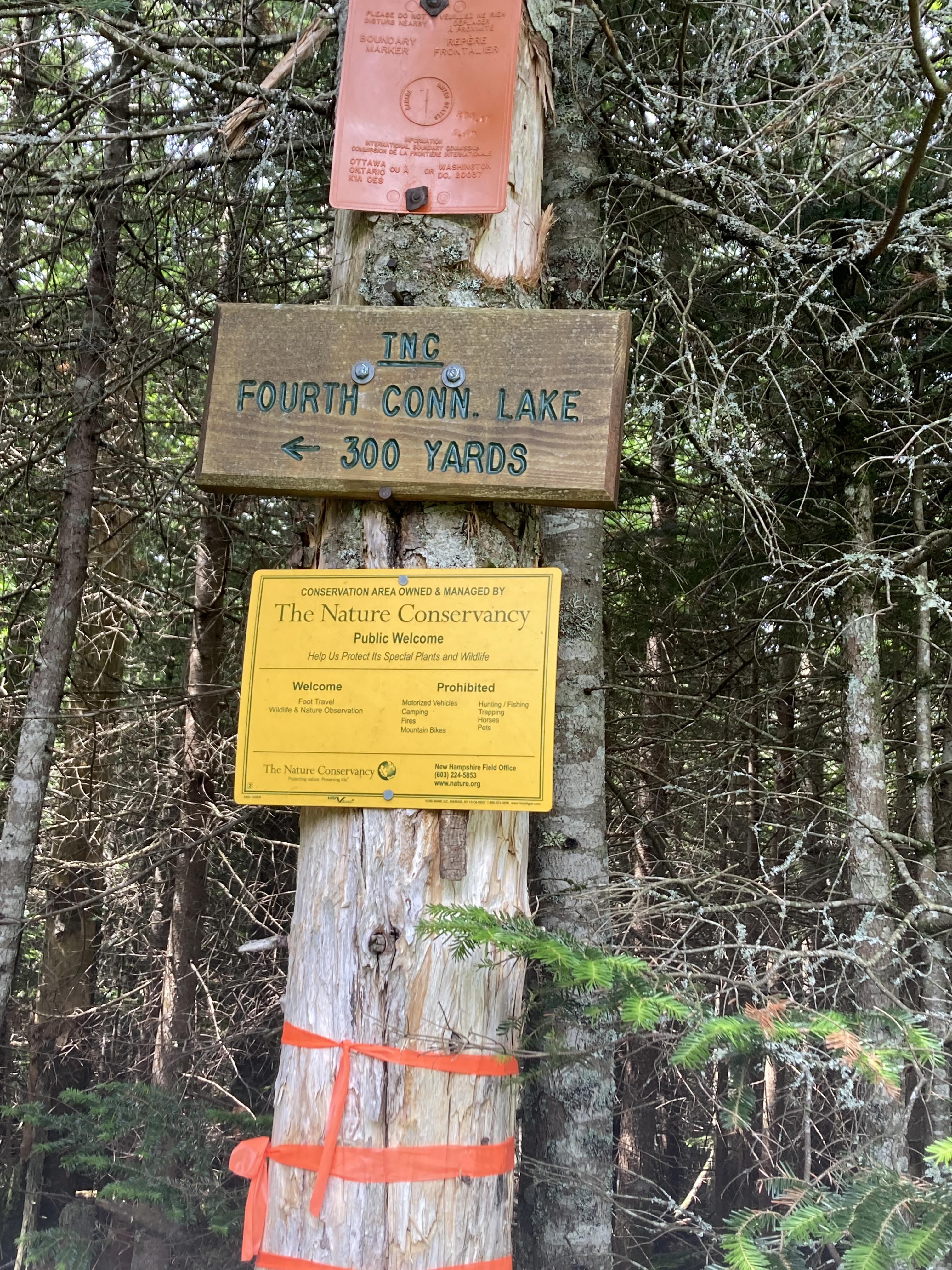
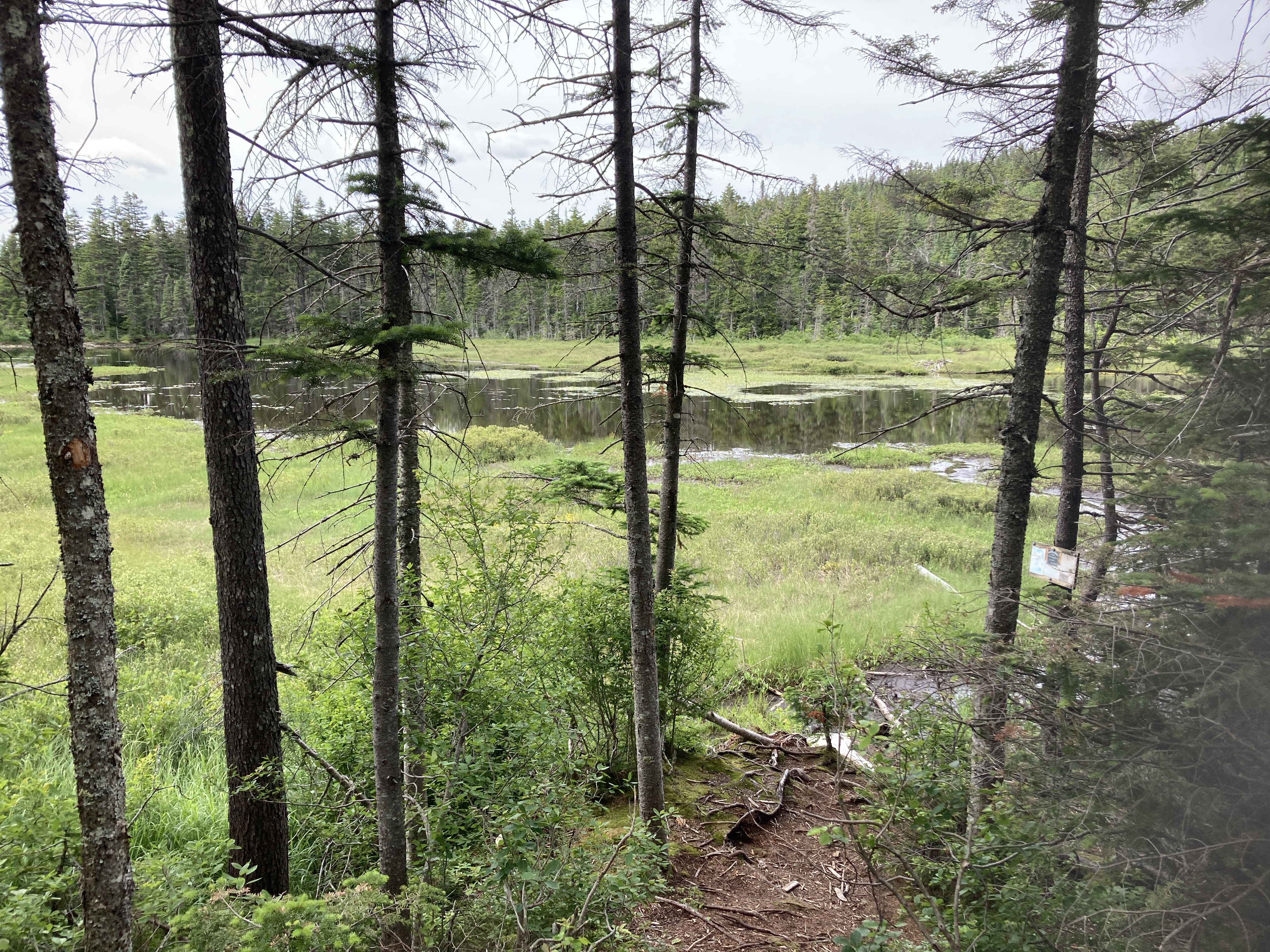
So, commencing a trip on the Connecticut River means paddling on a series of small lakes. The river bubbles up from the ground near the Pittsburgh/Chartierville border crossing on Rt 3. That is called Fourth Connecticut River Lake, and it is accessed via a hiking trail that zigzags across the US/Canadian border. No passport is necessary as you hike over brass markers in the ground telling you which side of the border you are on. We took a photo of our feet in two different countries. The views from the steeply inclined path are amazing. You can see for dozens of miles. Fourth Connecticut River Lake is a swamp created by water from springs. I suppose one could paddle on it, but you would have to carry your canoe or kayak up that steep incline for 45 minutes in order to do that. There is no car access.
Feet in two countriesIt’s quite a hike but well worth it! That’s the US Border crossing down below.
So, the actual journey of paddling the river starts on, you guessed it, Third Connecticut River Lake. This was the most crystalline of all the lakes. There we saw and heard our first loons of the trip. We had imagined paddling each of the lakes…there are three more to describe…from north to south. However, we discovered when we arrived that most only have one access point so in order to do that we would have had to paddle to the far end and then south and then back to the access point. Not enough time nor inclination for that. Instead, we settled our sights on just paddling some part of each lake over the two days we had allotted for the trip. We managed our hike and paddling on the Third Lake on our first day there. That evening we tried moose sightings at Scott’s Bog because, according to the locals, early evening is when to spot them. Again, it’s a ploy. But the bog was beautiful, and we stayed, eyes glued on the water’s edge, until the lack of light made our eyes hurt and we began seeing things that weren’t there. Karen is still pretty sure she saw a moose…or some deer…but in the waning light boulders can resemble just about anything.
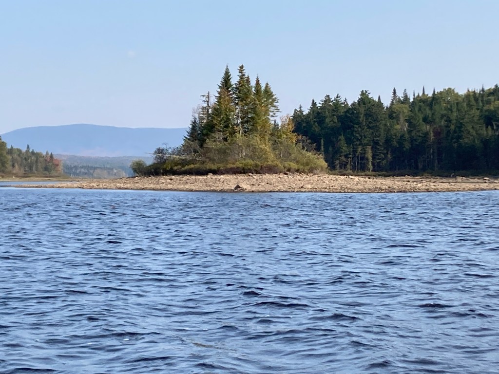
On day two we headed out to Second Connecticut River Lake. The lakes are numbered in descending order which has a tendency to confuse the brain. Each of the lakes is either naturally (First Lake) or artificially dammed. You can read more about that here. We paddled out and around what looked like an island but, perhaps due to dropping water levels, was no longer an island. We managed to push through some shallow water and made our way back to the access point. Again, stunning fall colors and gentle waters.
The wind started kicking up as we pushed out onto the waters of First Connecticut River Lake. With headwinds and high waves, we decided to make is a very short paddle just to say we had paddled on that lake. Unlike paddling the Ohio River, which offered fierce headwinds on a regular basis, and required us to keep up the paddling as long as we could despite the winds, we opted for the wise way out this time. We went back to the cabin for lunch, naps, and reading in the afternoon.
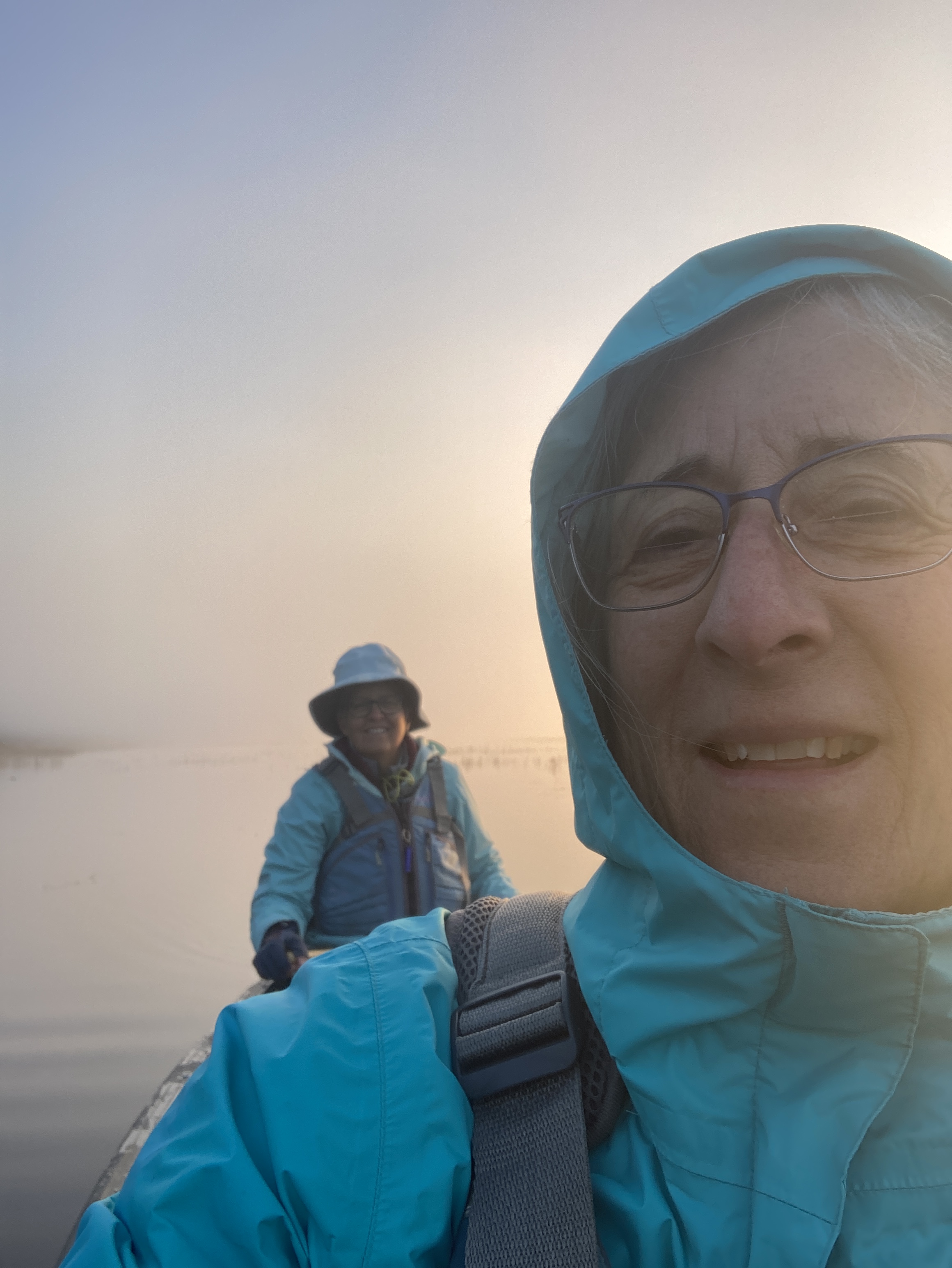
Our faithful transport team!Scott’s BogEast Inlet Lake sunriseChilly, misty morning on East Inlet
Later in the afternoon, we headed out for ice cream with John and Mark…and then another moose hunt. A sucker is born every day. Again, a ploy but we enjoyed the beauty of East Inlet Lake and were advised by two photographers that the moose were rutting and hard to spot but if we wanted to try to see one, come back in the early morning.
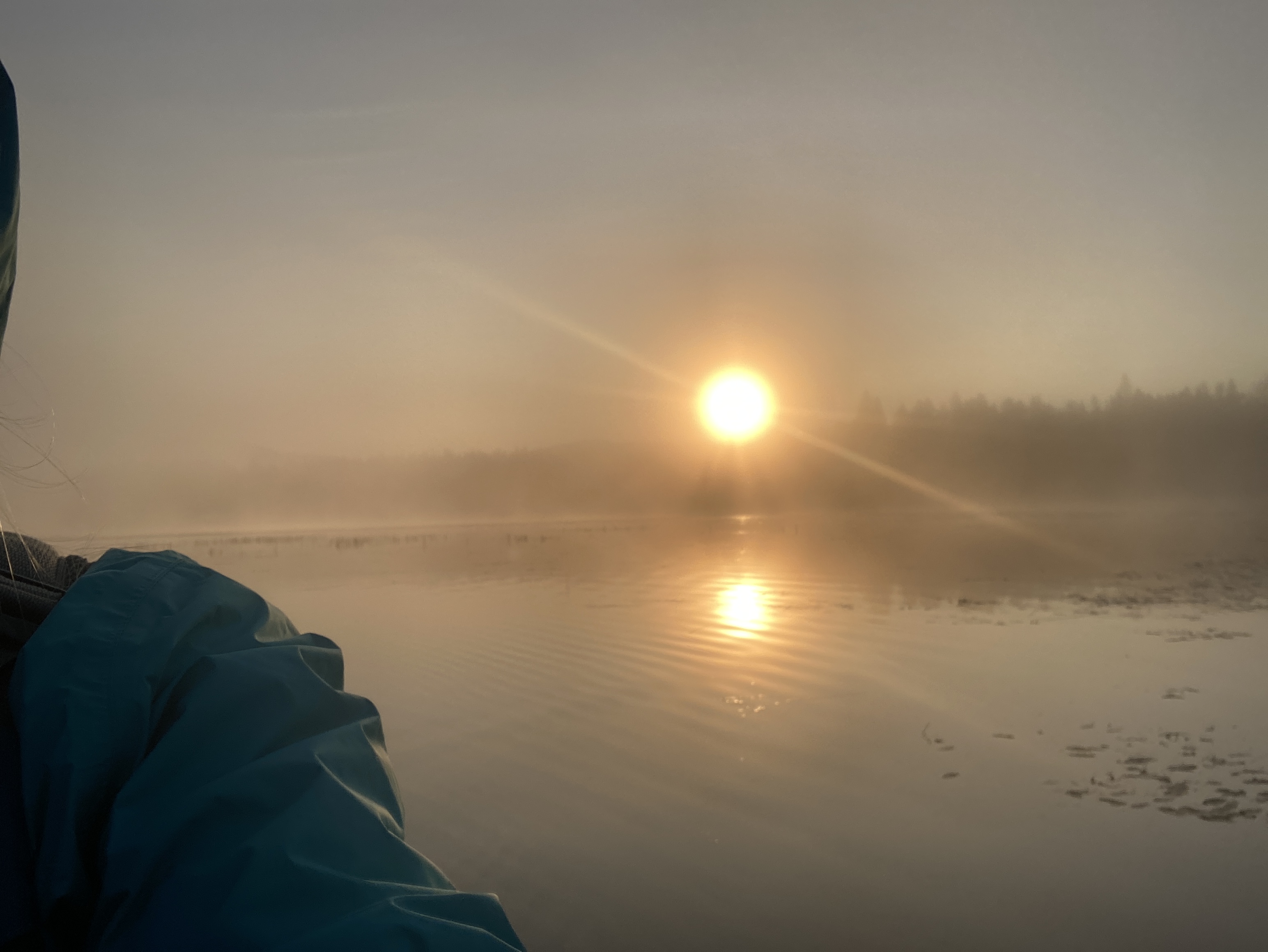
Yep, we succumbed once again to the search for the elusive moose and set our alarms for 5:30 am and headed out in 37-degree weather to put our canoe in the lake and paddle in the mist. And yep, you guessed it again. No moose. But we enjoyed a gorgeous sunrise through the morning mist.
Lake Francis was the last stretch we could do before getting to the shallow parts of the river that are best left to brave kayakers or folks tubing in the summer heat. I wonder why they didn’t name it Fifth Connecticut River Lake? At the base there is a 100 foot dam. There were two access points on Lake Francis, so we were able to paddle about 3-4 miles. John and Mark dropped us off at the state park at the north end and spent some time enjoying the antics of loons. Karen and I continued to marvel at the beauty of the hills and mountains and changing colors of autumn. The guys picked us up at the south end of the lake near the dam, and from there we headed home, passing the access point in Canaan, Vermont, where we will put in next spring and begin what we are imaging to be a “paddle through” of the river…perhaps three weeks of adventure at one time, instead of doing it in short stints. This is the advantage of us both being retired now. We can plan for trips that are longer than our usual 6 days. Time will tell as to whether we manage that or not, but we have learned that setting goals always, always, gets us down the rivers in whatever time we have.
Here’s to a new adventure and something to look forward to next spring.
On May 28th, we will head into the Susquehanna River in Sunbury, PA, with plans to complete the 444 miles of the river in Havre de Grace later in the week. This will be our first try at paddling into salt water which means we have the added challenge of timing our arrival so that we are literally going with the flow of the tide. We know that a rising tide floats all boats…but we don’t need any resistance against us at that point. The headwinds of the Ohio River were hard enough.
If you are reading this and happen to live near or on the Susquehanna River between Sunbury and Havre de Grace, let us know. We are always looking for warm showers and flush toilets. Seriously.
The mysteries of the river await us. The chance encounters with kind people will be there. The weather looks to be reasonably clear with perhaps a few rain showers on our first day. The temps appear to be neither too high nor too low. It is time to throw ourselves out there again and wait for the stories and adventures to come to us.
With the help of Maggie’s sister Christy Smith and brother and sister-in-law Don Monroe and Kim McDowell, Maggie will find Karen below the Ashokan Dam outside Sunbury. Karen always arrives with our faithful canoe, Wonder, atop her Subaru. Right now, in our respective homes, we are wondering what we are forgetting even knowing that our needs are always addressed in some way. In fact, this week each year is the reminder that we really don’t need much at all to travel through life on this planet of yours. Some food, some water, and a few pieces of clothing are all we need for a week.
We set off this year in the midst of the continuing pandemic, a miserable and uncalled for war in Ukraine, mass shootings, racial strife…seems like more bad news than ever at one time across the globe. This one week each year in the canoe is our retreat, however brief, from the news and from our responsibilities at home and/or at work. We will return refreshed, by nature and by our friendship, and hopefully ready to enter the fray once again.
Hum. Interesting title. What do I mean. Asphalt shingles on a river? No. How about SHINGLES shingles.
Shingles, also known as herpes zoster, is a painful skin rash caused by reactivation of the varicella zoster virus (the same virus that causes chickenpox). If you’re one of the approximately 99% of adults over 50 years old who have had chickenpox, the virus that causes shingles is already inside your body. It can reactivate at any time, and your risk increases as your immune system naturally declines with age.
Trust me on this. You do not ever want to have shingles. I’ve heard plenty of stories from people who have had it but never took their pain seriously, I guess. It is painful and itches. And did I mention it is painful? The virus attacks the nerves in any part of your body. For me it was from the middle of my chest to the middle of my back, wrapping around the left side of my body. Imagine a wasp’s nest under your armpit. All day and all night.
One day into our trip in 2020, I noticed pain in my back and itching in the middle of my spine. I was sleeping in a tent and paddling a canoe. Back pain and itching are not uncommon. By day three I was writhing in the night, clenching my muscles, and trying not to cry out. I took pain relievers but they didn’t touch it. I asked Karen to look under my armpit where some of the itching was and she saw just two small dots like bug bites. I never asked her to look at my back and didn’t see it myself until our trip was over and we were in a motel with a mirror. Yikes. It was nasty. But what was it???
The amazing thing was that while I was in more pain than I ever remember being in, I kept paddling. Perhaps ignorance of my condition or sheer determination not to ruin this once a year adventure or some combination of both got me through. I think that says more than enough about my love of adventure, being with Karen, and paddling the rivers.
But this condition was also the reason that I did not log our adventures into this blog after the first two days. With Karen’s help and the notes that she keeps on our river maps, I will try to update the blog so that we have our story to remind us of our adventures when our aging minds begin to fail us like my body did last year. Hope you can read a bit of sarcasm in there…we really plan to paddle into our senior years and sleep in tents by the rivers as long as we possibly can.
On a humorous note…we do realize we are aging and our bodies our changing. We don’t talk about it much but last summer was one of those times. Perhaps even though we didn’t know what I was suffering from, just the suffering was enough to get us pondering what we would do if one us just dropped dead while canoeing. I don’t need to elaborate but the images of what we would do got us laughing pretty hard as we kept paddling down the river.
If you are at least 50 years old and have not had your shingles vaccine, get it. I know we are tired of being poked by needles with COVID vaccines and booster shots but just go get it. And don’t worry about the price though it is too high. Knowing what I know now, I would have paid just about anything to avoid that experience.
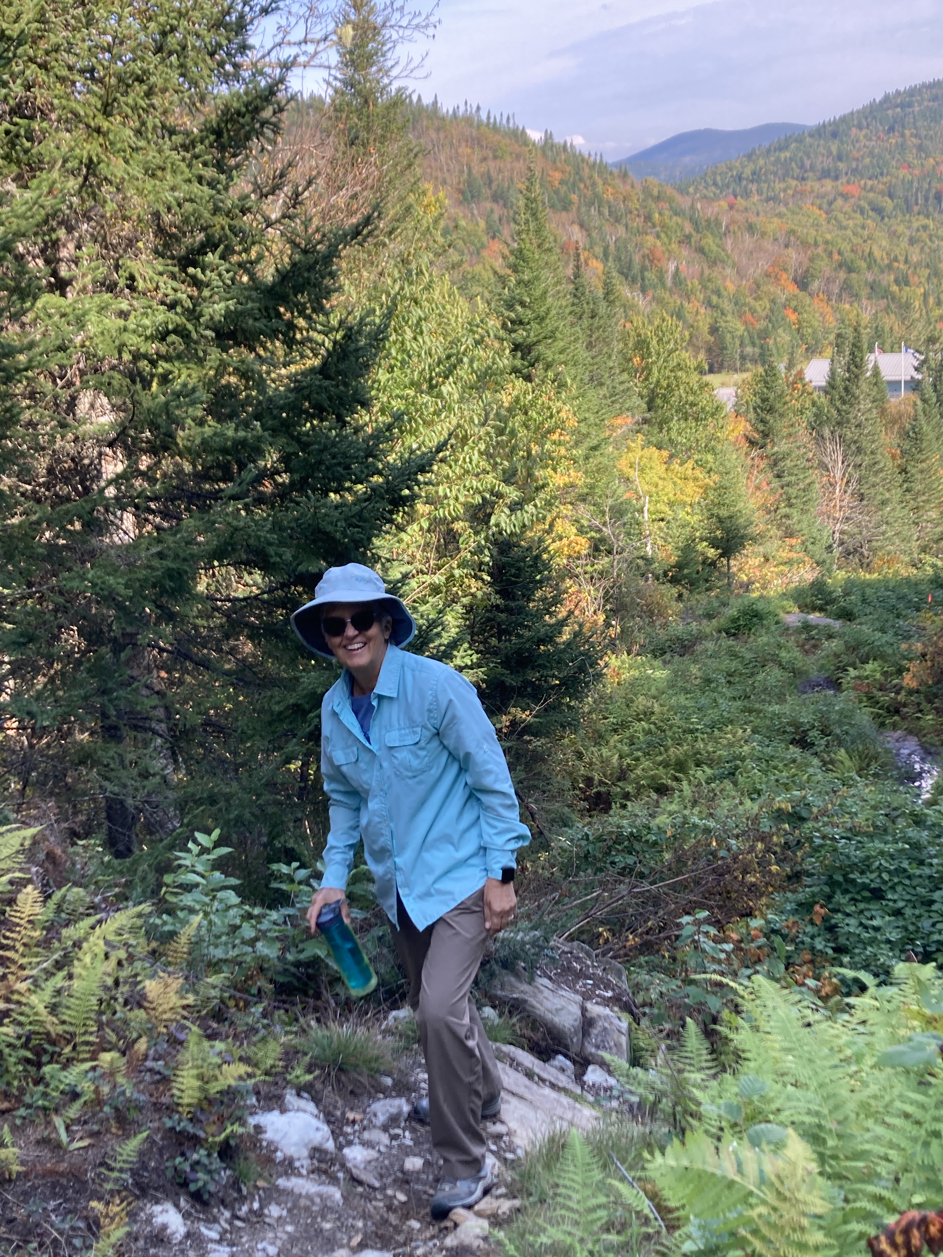
We are already thinking about our next river. In 2023 we hope to embark on our journey near the headwaters of the Connecticut River and “paddle through.” That means that we will do it all in one trip which may take us 3-4 weeks! In anticipation of this paddle, John and I did some reconnaissance in July 2021 and went in search of the headwaters in northern New Hampshire. It was really north, the bit of NH that juts up into Canada. We were wowed by the untamed beauty of that area which included the old time feeling of going on vacation before McDonald’s and Walmart signs spotted so much of our landscape. It was amazing.
To start with, I read up on how to get to the bog that is the headwaters and found this information from the Nature Conservancy:
The Connecticut Lakes, unlike the lakes of New Hampshire’s Lakes Region, possess a wild, pristine beauty of their own, despite the fact that they are man-made. The central feature of the small region which makes up the very northernmost tip of our state, they are the source of the mighty Connecticut river. Three of the lakes can be seen while driving north on Route 3, and all are worth a short stop to admire their scenery. The fourth lake, located up on a hill on the Canadian border is not as well known because it is not visible from the road. This little marshy pond is the true source of the Connecticut River.
The area around the lake is owned by The Nature Conservancy, and is accessible via a short hiking trail, which begins at the border crossing station. To get to the trailhead, walk along the fence on the right side of the building, then head toward the large wooden border crossing sign. The small Nature Conservancy kiosk is just beyond that. The trail begins here and follows the boundary clearing up the side of Prospect Hill. This area is filled with small shrubs and ferns, and the path through it is somewhat narrow and muddy at almost all times of the year. The beginning of the trail is very steep. Just a short way up, you will encounter a small marker set in a rock. This is the first of many plates along the trail marking the US/Canada boundary. The trail continues to weave in and out of Canada as it goes up. As the trail begins to rise, you can look back and get a completely unique view of the Boundary Mountains. After 0.6 miles of climbing, the trail bears left out of the boundary clearing and heads into the woods. In the last 0.1 miles, the trail descends 50 feet through the forest. The lake soon comes into view and the trail splits into a loop at its shore. Here, the tranquility of the Great North Woods surrounds you as you gaze out over the water. Grasses and reeds blow with the breeze; you may even see a beaver. The view of the lake from this point is very nice, but you will experience much more by taking the 0.6-mile loop trail around the pond. The trail is muddy, but it has boardwalks over most of these areas. There are many viewpoints of the lake from the trail. At the south end of the lake, you will step over a small brook. This may be the most exciting part of the hike, as this tiny stream is actually the Connecticut River!
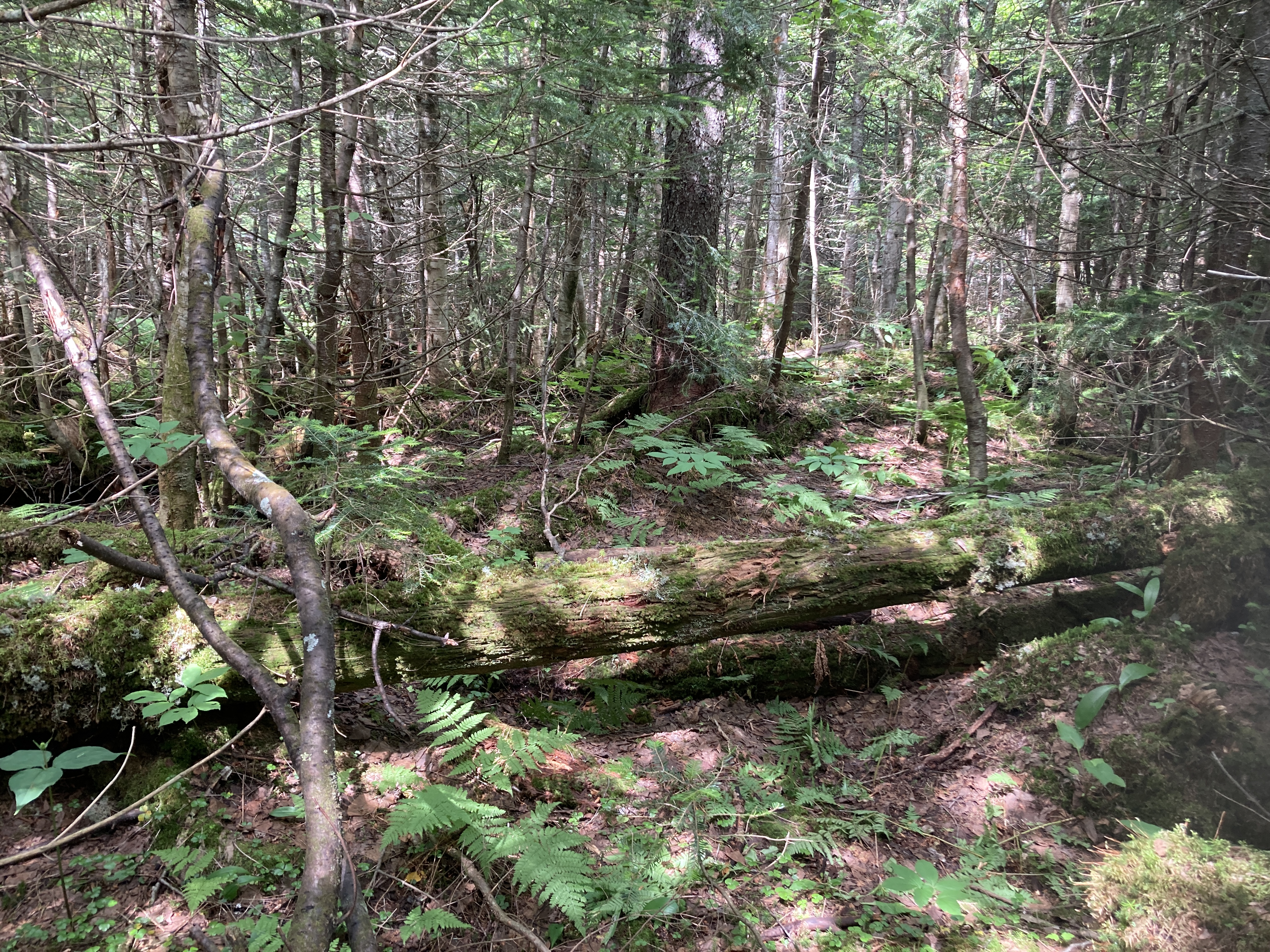
But don’t be fooled by the “short hiking trail” description. Yes, it is short…just over a mile up to the bog. But it is pretty much straight up with occasions where I was crawling over boulders. Round trip took me 1 hour 40 minutes. Just for comparison, I usually walk 3 miles an hour. It was a stunning hike, however, with incredible views of the mountains around. It was also a bit exciting to be hiking the closed border between Canada and the US. COVID restrictions were still in place but there was no one stopping the other three hikers and me from our quest that zigzagged us back and forth across the border marked by metal stamps set into concrete.
From the bog called Fourth Connecticut Lake, the stream flows to Third, Second, and First Connecticut Lakes and then into Lake Francis. Two of the lakes are created by human made dams. One, at least, functions as a hydro dam. Again, they are all gorgeous, hardly populated, and simple. The river between them is shallow and strewn with rocks and boulders and therefore not reasonable for us to manage in our canoe but I think that we could paddle the four major lakes just to say we did it, portage where we can, and then hop back on the river near Canaan, Vermont, where most through paddlers start. From there we will have 373 miles of the 410 miles from the headwater to paddle to the Long Island Sound.
The Connecticut River Conservancy has done a lot of work to educate people about the river and create a welcoming atmosphere including maps about boat ramps, portages, and camping sites. Click here for more information.
Meanwhile, it’s time to start planning our last leg of the Susquehanna River this summer. As I write, the winds are howling outside our Vermont home with a snow storm and wind chill temperatures significantly below 0° F on their way this weekend. But it won’t be long before we are back on the Susquehanna in Sunbury, heading to the Chesapeake Bay.
We were on the river for 11 hours today, leaving our idyllic asylum at 6 am. It seems we are more apt to get going early in morning on the first days of our trip. As the days go on, our bodies grow weary and achy, and we lose sleep in the night, it is much more difficult to get going that early. We made several stops for meals or walking around. We were pleased to have had a rain-free day as the weather report was dubious. We managed 32 miles so we are ahead of our goals and that is good as we never know what we may run into than could slow us up.
We may get some thunderstorms tonight and early morning, but we expect to be back out on the river for mostly a nice day. Saw numerous does with fawns – so cute! They are always out on the river banks early in the morning. We also saw 5-6 bald eagles and a very wet raccoon crawling out of the water. We camped on an island and arrived early enough to really enjoy relaxing.
Over the years we have camped in all sorts of conditions and found, by and large, that we can manage most conditions for a night. This year we learned that what looked to be uncomfortable turn out to be quite comfortable: sleeping right on a bed of small, smooth river stones. With our camping maps, the stones became a good foundation for sleep.
Of course, an important part of our paddling is our stops along the way to find interesting history or, in many cases, to seek out refreshment! And we were also able to charge our cell phones.
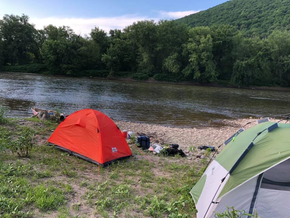
We met in Sunbury, Pennsylvania at around 2 o’clock this afternoon, Karen having traveled from Jamestown and Maggie from Vermont. We were fortunate to be able to leave a car in a state park in Sunbury where we hope to end on Thursday or Friday. And then we drove up to Towanda where we ended last year. The local mechanic let us leave another car there and by 5 o’clock we were out on the river. We intended to paddle for about 5 miles to a rustic campsite that was on our map but we couldn’t find the campsite and kept on paddling. 10 miles in we found this amazing place called French Azilum. We have Marie-Antoinette to thank for this place as it was developed in hopes that she would escape the French revolution and her life would be saved here in Pennsylvania. We all know how that ended. But we’re grateful to have an asylum of our own here on the banks of the Susquehanna River.
This is a well-marked ramp and a welcoming campsite. Information about the Azilum (asylum in English) is on a board at the top of the ramp and a box to make a donation for the campsite is also there. As we walked up the ramp we were pleased to discover this huge, flat hay field and a mown trail to the house (which was not open when we were there) and a mown area for setting up several tents. Included in the surprise gift was a picnic table and a fire pick and even a stack of old fence posts and other wood we could use for a fire.
It was perhaps the most perfect and easy of all the campsites we had set up. And we were pleased to be further on our journey than we had expected to get in those first evening hours.
This past week John and I took a trip to the DC area to be present for the funeral of my brother-in-law, Tony Smith. It was a sad trip as we said good-bye but there was also the life-affirming nature of reconnecting with family and close friends. A Viet Nam vet, Tony succumbed to cancer at age 74, most certainly the result of his exposure, decades ago, to Agent Orange. As though that war was not complicated and difficult for all involved on all sides, its vestige continues all these years later as aging soldiers fall to similar diseases.
On the way back to Vermont from MD we travelled along the Chesapeake Bay up to Havre de Grace, the mouth of the Susquehanna. That is where Karen and I will end up, hopefully, next year. We will then have three full river lengths under our belts (or paddles, if you will): the Allegheny (well most of it), the Ohio, and the Susquehanna. We are paddling towards 2000 miles together over the last twenty years.
A river runs through it is such a great phrase. The movie by that name captured the hearts of many of us nearly 30 years ago (1992). Rivers have run through our lives since first setting out on this paddling journey. Yes, I refer to the abovementioned rivers but also to the streams of change, excitement, challenge, hope, life, and death. While Tony is the first of our generation to leave my family, other generations have gone before him. Both Karen and I lost our mothers and she lost her father since we started out. My father had already died when we began this journey which is probably a good thing. He would have thought us crazy and worried much more than my mother, I think. Wars and pandemics have raged.
Our children have become adults, married, and had children of their own. We have moved into new homes in new places with plans in the making for yet another new home for Karen and Mark. We have made new friends along the way, separately and together. We have become open to new ideas and careers.
And a river runs through it. The life-giving, constant flow of water. Both Karen and I never fail to be thankful for what life has brought us in our families and work lives…and in the once-a-year journey that takes us on the rivers of America. And so, as long as our aging bodies will allow, we will continue to paddle the rivers, sleep on their banks, and meet the fine people who live along them.
Next Saturday we will set out from our respective homes to meet in Sunbury, PA, where we hope to end this year, and drive together upriver to Towanda, PA, where we ended last year. By Saturday evening we plan to be a few miles down river. This coming week we will check our camping gear once again, take inventory of our dehydrated meals, wonder how many meals we can eat in restaurants that we find along the way (a lot, we hope…especially with fewer COVID restrictions than when we paddled last year), and check the long-range weather reports to see if we will hit the inevitable thunder storm or two.
Final preparations are no longer as specific as they used to be because we have learned so many times that the river and its people take care of us. As long as we have a little food and water, our tents, the canoe, paddles, and life vests, we know we will be ok. Can’t wait to detach and push that canoe, Wonder, out into the flowing waters of the Susquehanna River once again. Our muscles may bind a bit more and our bones creak but our spirits will soar!
John and I took the riverside road instead of I91 to Springfield, VT, yesterday to do some grocery shopping. One thing that COVID has done for us is to force us to shop in Vermont instead of going over the river to NH where the big grocery stores and Home Depot are. Our governor is pretty strict about not leaving the state unless we absolutely have to. So we have found new stores on our side of the river. Even lumber stores that I previously didn’t know existed. And for those who know me well, you know that a new lumber yard to me is like a new coffee shop to a caffeine addict.
However, the down side is that I don’t cross the Connecticut River twice a day as I did when I was working full-time in Claremont, NH. I loved seeing the river in its different seasons. Yesterday, I marveled at how the river had frozen with a very smooth surface that you could ice skate on. In the past the river tends to freeze and thaw, leaving chunky looking river until the ice goes out in the spring. It has been a cold winter in New England and, with the exception of a few days around Christmas when it rained and all the snow melted, there have been steady cold temperatures and lots of snow.
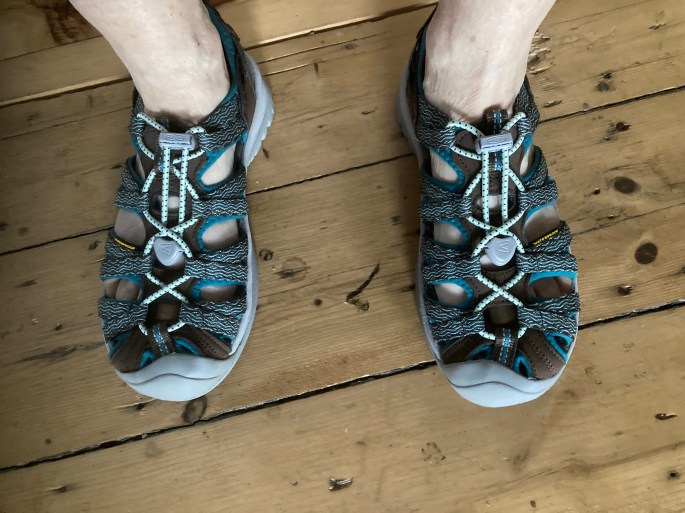
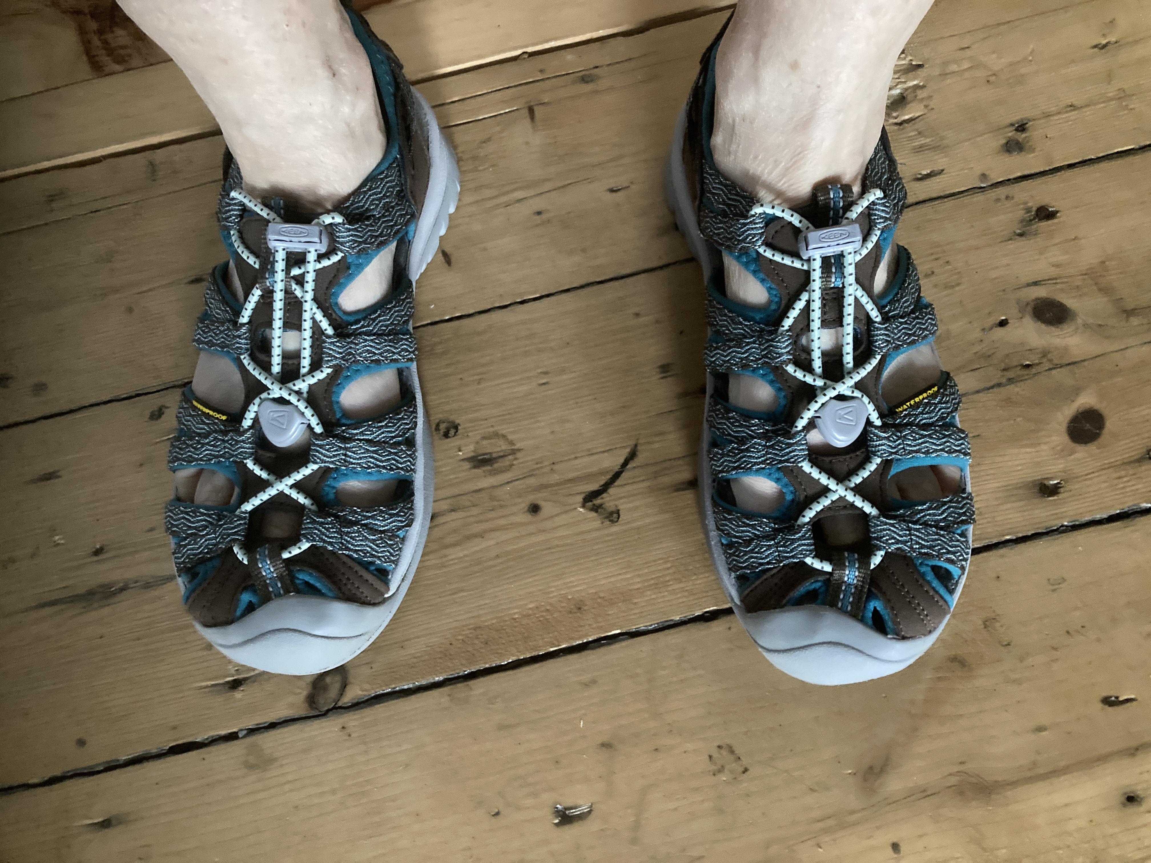
It was great to see the river again and wonder when the ice will finally break up. And it takes me to the next leg of our Susquehanna River trip. I’m sure the Susquehanna is pretty seized up with ice as well right now. While it is cold and snowy everywhere, my blood starts flowing as I imagine the rivers flowing again. To add to that, a package came in the mail today with my new Keene water sandals. Karen has been encouraging me for a few years to purchase of pair. They will replace my too small quasi-crocks which actually shrank in the sun a few years back. I still wore them but portaging last year was hard on my toes and ankles. So I’m excited to have this new “gear.” The old crocs will go in the trash, I think.
Karen and I spoke on the phone the other day and we have plans to be back on the Susquehanna River in late May or early June. We want to get in the river when there is still enough water to carry us along with little bottoming up on the shoals and having to drag the canoe. However, northern PA is still chilly in May or early June, or at least can be, so we don’t want to be cold either. We know very hot and very cold on rivers. Neither is fun but very cold feels dangerous at times. I will be fully vaccinated by early May and Karen has already had round one so between that and the fact that we don’t share a tent and we are far away from civilization most of the time, we feel pretty safe for ourselves and for others.
Every time I tell a new person the story of our canoeing adventures over the last 20 years, I seem to get the same response: Why? And my answer is always: I don’t really know. It is just something that evolved as gracefully as my friendship with Karen evolved over the years. It evolved as things do…one thing or thought leads to another. If anything, I would answer that question today with a simple: It was something that manifested itself and we followed. Or maybe better to say that we let ourselves be carried along just as the rivers have carried us since we first put in at Red Bird Corners in Western New York. It kind of started with a “I wonder what it would be like to put a canoe in Cassadaga Creek and paddle to New Orleans?” We wondered and action followed and here we are still paddling some 20 years later. Our bodies creak and moan a bit more each year but we will keep going, sleeping on the ground in tents along the banks of whatever rivers we can get to, until we can’t do it anymore. Hopefully we have many, many more years ahead of exploring both the rivers and our friendship.